
ArcGIS Spatial Analyst
January 31, 2024 | 11 am IST onwards
ArcGIS Spatial Analyst
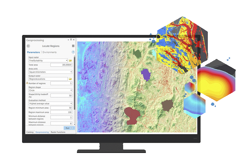
The ArcGIS Spatial Analyst Extension stands as a cornerstone in the realm of GIS, it offers advance tools for spatial data analysis and modeling. Key strengths of spatial analyst extension is to engage users in advanced raster analysis, exploring techniques to manipulate and analyze vast amounts of raster data efficiently. The extension facilitates terrain analysis, enabling the creation of accurate surface models and the extraction of crucial elevation-related information. Additionally, it provides a robust set of tools for hydrological modeling, allowing users to simulate water flow, delineate watersheds, and assess the impact of terrain on water movement.
Spatial modeling is another highlight of the extension, offering users the capability to simulate and predict spatial phenomena. This is particularly valuable in fields such as environmental science, urban planning, and natural resource management. By providing tools for interpolation, the extension facilitates the estimation of values at unsampled locations based on the values of surrounding sampled locations, enhancing the precision of spatial analysis.
The ArcGIS Spatial Analyst Extension isn't just a tool; it's a gateway to a deeper understanding of spatial relationships, making it an indispensable asset for organizations seeking to extract actionable intelligence from the ever-expanding landscape of geospatial data. Whether it's optimizing routes, assessing visibility, or predicting environmental changes, this extension empowers users to navigate and derive value from the complex world of spatial data with precision and confidence.
Key Takeaways
- Introduction to ArcGIS Spatial Analyst
- Raster Data Manipulation and Analysis
- Performing Hydrological Analysis
- Distance & Cost Path Analysis
- Interpolation of Data values based on sample data.
- Perform statistical calculations based on zonal areas, or local environments.
Who should attend?
GIS Professional, mapping organizations, remote sensing specialists, hydrologists, and researchers working across several verticals to uncover patterns in the data.
Speaker

Kunj Kishor Shethiya,
Esri India